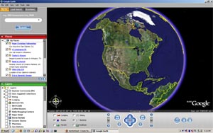
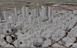
 I downloaded and installed Google’s latest free offering, Google Earth. It’s an application providing satellite photography of the whole Earth. Detailed coverage is available for the U.S. and a handful of other countries. This means you can zoom in and see objects as small as your car. The photos are not real-time but represent a collection from different satellite providers taken in the last 3 years. Still it is pretty impressive. The animation is quite seamless as you zoom in from outer space right down to your street. They have even included rendered building shapes for 38 American cities. This along with the ability to tilt the map at a 45 degree angle allows you to get a feel for the shape of the city skyline.
 Other cool features include driving directions (with a fly over perspective), ability to place markers at specific locations, and the price = $0. I recommend downloading and trying it out, especially if you enjoy mapping things or looking in your neighbor’s backyard. It does require a somewhat modern graphics card and reasonably fast internet connection to enjoy the full experience. Well done, Google, well done.
